Home
> Seismic networks
> Profiles
Profiles
Network XF_2024
- Scientific goal : supplement the broadband network for imaging the crust (to 30-35 km depth) at km to deca-km resolution, along profiles crossing volcanic zones and the main faults (e.g. Sillon Houiller, Limagne faults) of the Massif Central. Recent experiments designed to image the lithosphere have shown that it is essential to supplement broadband sensor arrays with medium-band sensor profiles to image crustal structures at a resolution approaching that of geological maps (for example, Chevrot et al. 2015, Paul et al. 2022).
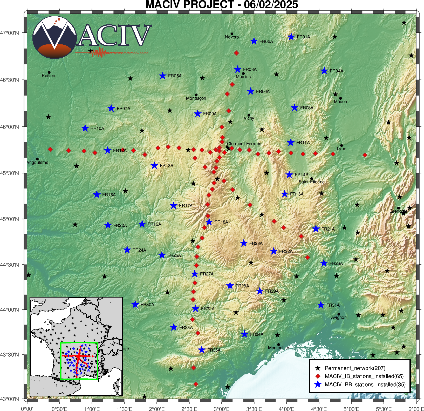
- 65 medium-band stations on 3 profiles (red diamonds on the map) :
- North-South profile (or NNE-SSW, station code MNxx) : 425 km long, 36 stations across the main Variscan sutures and blocks, and along the main volcanoes of the Chaîne des Puys.
- East-West profile (station code MExx) : 360 km long, 35 instruments across the main Variscan nappes along a profile perpendicular to the Argentat detachment, the Sillon Houiller, the Chaîne des Puys and the Limagne grabens.
- diagonal profile (NW-SE, station code MDxx) : 170 km long, 8 stations across the volcanic centres of the Velay, Devès and Bas-Vivarais.
- Inter-station distances increasing from 5 km in the central parts (Chaîne des Puys) to 20 km at the ends.
- Instruments : TC120PH and CMG40T velocimeters, with Centaur digitisers from the Sismob - Epos-Fr national pool .
- Real-time data transmission to the Epos-Fr seismological data centre hosted by the OSUG via GSM modems.
- Remote supervision of network operation using the SyNApSE tool.
- Deployment period : minimum 2 years.
- These stations have been installed between June 2024 and January 2025 (site search started in November 2023). They will be dismantled in the first half of 2027.
- Estimated data size : 4.8 TB.
- Data access restricted to the project team in the first 2 years, then public access, distributed by the EPOS-France seismological data centre.
Updated on 12 mars 2025


